The National Weather Service has turned up the alert level for a trio of states tonight, issuing a severe thunderstorm watch that covers parts of Illinois, Kentucky, and Missouri. This advisory, effective until 9 PM CDT, warns of scattered hail up to two inches in diameter, isolated wind gusts reaching 70 MPH, and frequent lightning—conditions that could turn a quiet evening into a dangerous one for more than a million residents.
This latest watch follows a broader alert earlier Tuesday that had already put six states—Arkansas, Louisiana, Mississippi, Missouri, Oklahoma, and Texas—on notice for a powerful storm system capable of producing hail larger than four inches, destructive winds, and multiple tornadoes. The National Weather Service described the potential for “multiple rounds of severe thunderstorms” across the southern Plains into the lower Mississippi and Tennessee Valleys, with “very large to giant hail” and swaths of damaging winds.

Now, the focus narrows to the three states in the crosshairs tonight. The severe thunderstorm watch for Illinois, Kentucky, and Missouri is a serious call to action, especially given the recent tornado watch alert for Missouri and Illinois that kept residents on edge earlier. The combination of large hail and strong winds can cause significant property damage and pose direct risks to anyone caught outside.
What to Expect: Hail, Winds, and Lightning
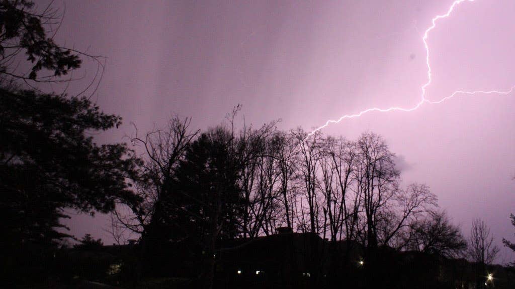
Forecasters are highlighting three primary threats: hail up to two inches—roughly the size of a hen egg—which can shatter windows and dent vehicles; isolated wind gusts of 70 MPH, strong enough to down trees and power lines; and frequent lightning, which is always a danger during severe storms. These conditions are expected to impact an estimated 1.08 million people across the watch area, making it crucial for residents to stay alert and prepared.
The timing of this watch—late Tuesday evening—means many people may be at home or traveling. The National Weather Service has emphasized that being indoors is the safest option, but not all buildings offer equal protection. Sheds, storage facilities, and even trees are not safe shelters. In fact, taking cover under a tree can be deadly due to the risk of falling limbs or lightning strikes.
Safety Tips from the National Weather Service
To help residents navigate the storm, the National Weather Service has released a set of practical safety guidelines. Here’s what you need to know:
- Stay Weather Ready: Keep a NOAA Weather Radio or local news app handy to monitor updates on severe thunderstorm watches and warnings.
- At Your House: If a severe thunderstorm warning is issued, move to your secure location immediately—preferably a basement or interior room on the lowest floor. Take your pets if time allows.
- At Your Workplace or School: Stay away from windows. Avoid large, open spaces like cafeterias, gymnasiums, or auditoriums, which are more vulnerable to wind damage.
- Outside: If you're outdoors when a storm approaches, get inside a sturdy building right away. Do not rely on sheds or trees for shelter.
- In a Vehicle: Being in a car is safer than being outside, but if you can, drive to the nearest secure building. If you're caught in a severe storm, pull over away from trees and power lines.
This severe thunderstorm watch is the latest in a series of alerts that have kept much of the central and southern U.S. on edge. Earlier Tuesday, a giant hail and damaging winds alert covered six states, and forecasters have warned that the pattern could persist into the night. For those in the watch area, the key message is simple: stay informed, stay indoors, and take every warning seriously.
As the storm system moves through, residents in Illinois, Kentucky, and Missouri should prepare for the possibility of power outages, road hazards, and property damage. The National Weather Service will continue to issue updates as conditions evolve. For now, the best course of action is to secure loose outdoor items, charge your devices, and have a plan ready in case the watch escalates to a warning.
This is a dynamic weather situation, and the threat isn't over yet. With more than a million people in the path, tonight's severe thunderstorm watch is a reminder that springtime weather can turn dangerous in a hurry. Stay safe, and keep an eye on the sky.