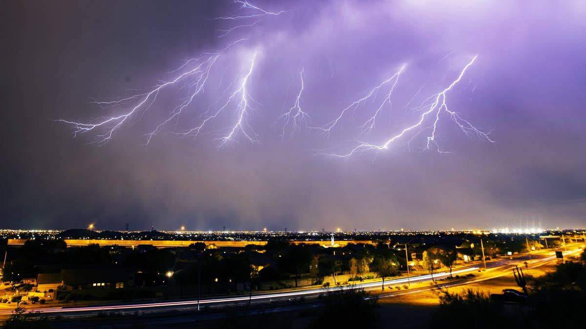
Get ready, Texas and Louisiana — Thursday is shaping up to be a stormy one. The National Weather Service has issued a serious thunderstorm watch for both states, warning that powerful storms could roll in with thunder, lightning, heavy downpours, gusty winds, and even large hail. If you're in the path, it's time to batten down the hatches.
This isn't your run-of-the-mill spring shower. Forecasters are eyeing a potent weather system that could pack a punch, bringing dangerous conditions from the Lone Star State all the way to the Bayou. The storms are expected to develop Thursday, April 30, and could linger through the day, so staying weather-aware is key.

What's on the Horizon?
The main threats include frequent lightning, torrential rain that could lead to localized flooding, and hail large enough to damage cars and property. Wind gusts may also reach damaging levels, making travel hazardous and potentially causing power outages. This comes on the heels of similar severe weather across the region — just this week, 6 States on Edge as Extreme Thunderstorms Target the South Wednesday showed how volatile the atmosphere has been.
While tornadoes aren't the primary concern, the National Weather Service hasn't ruled out the possibility of a spin-up. Residents should treat any severe thunderstorm warning seriously, as straight-line winds can be just as destructive. For context, Severe Thunderstorm Watch Hits 3 States Tonight: Hail, 70 MPH Winds, and Lightning Threaten Millions underscores the intensity of this spring's storm season.
How to Stay Safe When Thunder Roars
When severe weather strikes, your safety plan matters. Here's a quick refresher on what to do before and during the storm:
At Home
If a severe thunderstorm warning is issued for your area, head to your safe spot — ideally a basement or an interior room on the lowest floor. Bring your pets if you can. Stay away from windows, and avoid using electrical appliances or plumbing, as lightning can travel through wiring and pipes.
At Work or School
Move away from windows and avoid large, open spaces like cafeterias or gyms. If you're in a school or office building, follow the emergency plan and wait for the all-clear.
If You're Outside
Get inside a sturdy building immediately. Sheds, picnic shelters, and storage units won't cut it. And never take cover under a tree — lightning strikes and falling limbs make that a deadly choice.
In Your Car
A vehicle can offer some protection, but it's not ideal. If you can, drive to the nearest secure shelter. If you're caught on the road, pull over away from trees and power lines, and stay inside until the storm passes.
Keep an Eye on the Sky
With the storm season ramping up, it's wise to stay plugged into local forecasts and alerts. The National Weather Service recommends having multiple ways to receive warnings — think NOAA Weather Radio, smartphone apps, and local news. For a broader look at this week's storm threat, 7 States Bracing for Extreme Thunderstorms: Tuesday's Forecast Packs a Punch shows how widespread the severe weather has been.
As Thursday approaches, take a few minutes to review your emergency kit and plan. A little preparation can go a long way when Mother Nature decides to throw her weight around. Stay safe, everyone.