Mother Nature is cranking up the intensity across the southern U.S. this Wednesday, as a powerful storm system is set to unleash extreme thunderstorms on six states. From the Lone Star State to the Sunshine State, millions are being urged to stay weather-aware as the National Weather Service flags the potential for dangerous conditions.
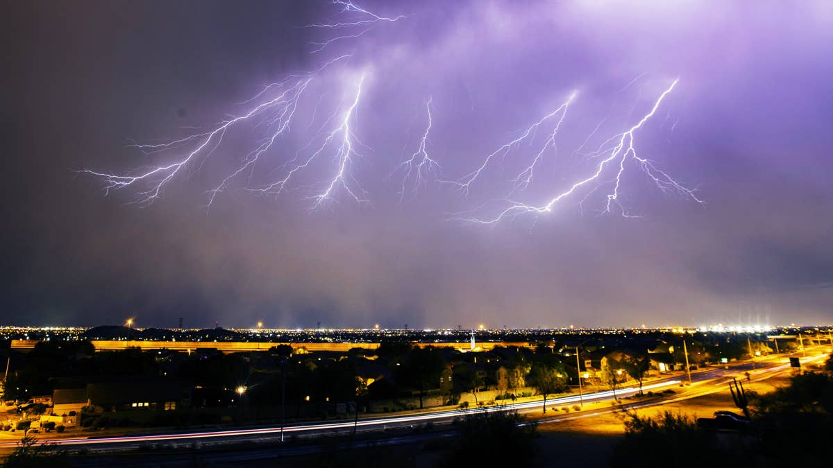
The primary threats include torrential rain, strong winds that could knock down trees and power lines, large hail, and a barrage of lightning. The states in the crosshairs are Texas, Arkansas, Louisiana, Mississippi, Alabama, and Florida.

Where the Storms Will Hit Hardest
Forecasters are zeroing in on a broad swath of the South, where warm, moist air is colliding with an upper-level disturbance. This volatile mix is expected to spark storms that could turn severe quickly. The National Weather Service has already issued alerts for these regions, urging residents to prepare now.
- Texas: The eastern half of the state could see the strongest storms, with hail and damaging winds possible from the Dallas-Fort Worth area down to Houston.
- Arkansas: The Natural State is no stranger to spring storms, and Wednesday looks to deliver another round of intense weather, especially in the southern and central parts.
- Louisiana: From Shreveport to Baton Rouge and New Orleans, residents should brace for heavy rain and gusty winds that could cause flash flooding.
- Mississippi: The entire state is under the gun, with the greatest risk of large hail and damaging winds across the central and southern regions.
- Alabama: Storms are expected to roll through the afternoon and evening, with the potential for frequent lightning and isolated strong gusts.
- Florida: The Panhandle and northern parts of the state could see severe storms arriving later in the day, adding lightning and heavy rain to the mix.
This isn't the first time this week that the South has been on alert. Just Tuesday, six states were on alert for severe storms with similar threats, and now the pattern is repeating. For those in the impacted areas, it's a reminder that spring storm season is in full swing.
How to Stay Safe During Severe Thunderstorms
When the sky turns dark and the thunder rolls, knowing what to do can make all the difference. Here are some critical safety tips from weather experts:
- Stay informed: Keep a NOAA Weather Radio handy or monitor local news for the latest watches and warnings. A similar alert for 60 mph winds earlier this week shows how quickly conditions can escalate.
- At home: If a severe thunderstorm warning is issued, move to a secure interior room—preferably a basement or an interior closet without windows. Bring your pets along if time allows.
- At work or school: Avoid windows and large open areas like cafeterias, gymnasiums, or auditoriums. These spaces can be dangerous if high winds or hail shatter glass.
- If you're outside: Get inside a sturdy building immediately. Sheds and storage units won't cut it—and never take shelter under a tree. Not only could the tree fall, but it also increases your risk of being struck by lightning.
- In a vehicle: If you're driving when a storm hits, pull over safely away from trees and power lines. Stay inside the car with your seatbelt on, and avoid touching metal surfaces.
Lightning is a particular concern with these storms. One strike can cause serious injury or death, so it's vital to seek shelter as soon as you hear thunder. Remember, if you can hear thunder, you're close enough to be struck.
This storm system is part of a broader active weather pattern across the U.S. this week. Earlier, a severe thunderstorm watch hit three states overnight, and the threat continues to expand. For those in the six states bracing for Wednesday's storms, preparation is key.
Stay safe, stay weather-aware, and keep an eye on the sky. This Wednesday, the South is in for a wild ride.