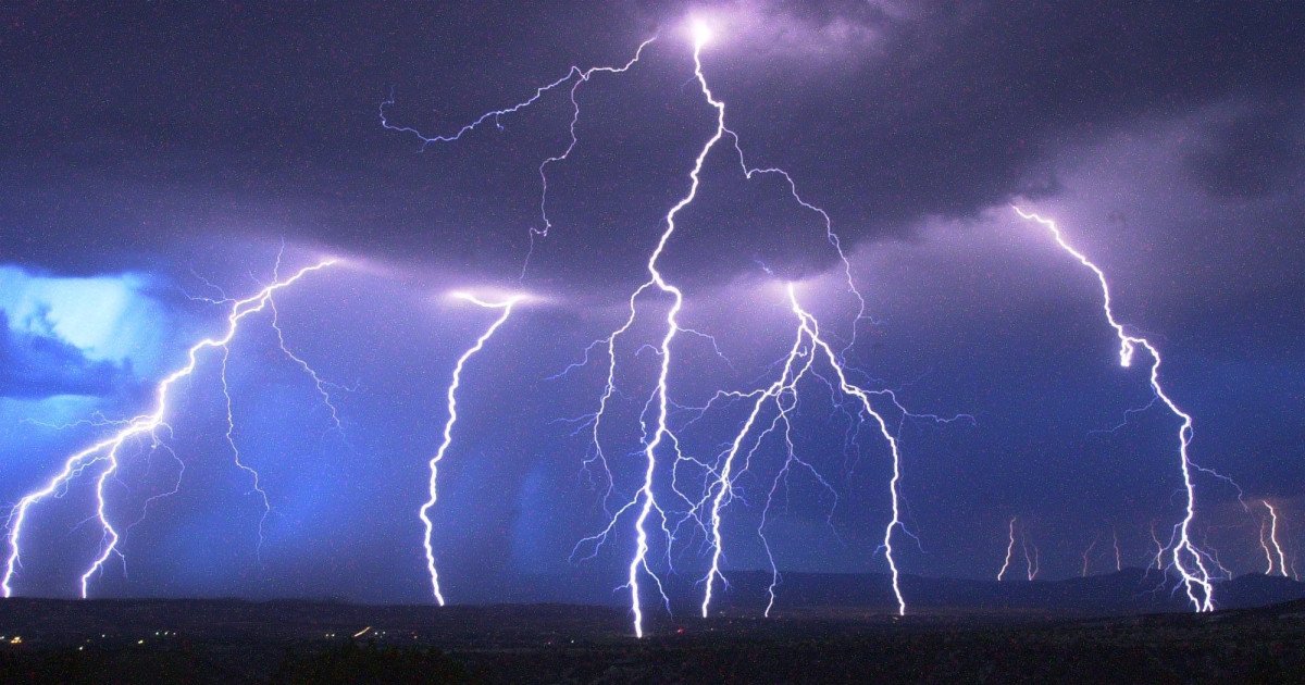
Sports fans and athletes across the Midwest, brace yourselves. A powerful weather system is gearing up to deliver a serious blow to the Ohio Valley region this Thursday, March 26th, forcing officials to sound the alarm. The National Weather Service has significantly upgraded its warning, declaring an Enhanced Risk—a Level 3 out of 5—for severe thunderstorms capable of unleashing a destructive combination of massive hail, hurricane-force winds, and tornadoes.
A Formidable Forecast
The incoming storm isn't playing around. Forecasters warn that the most intense cells could produce hail the size of baseballs, measuring up to three inches in diameter. Winds are expected to scream past 70 miles per hour, strong enough to cause significant structural damage and uproot trees. The Storm Prediction Center specifically highlighted the potential for "supercell" thunderstorms, which are notorious for spawning the most violent weather, including tornadoes.

"The strongest storms will be capable of producing large hail, damaging wind gusts, and a few tornadoes," stated the NWS in its urgent update. This elevated threat puts a major portion of the country's heartland directly in the crosshairs.
States in the Strike Zone
The core of the danger zone centers on three states facing a heightened 30 percent risk for tornado activity: Illinois, Indiana, and Ohio. This severe weather threat could lead to significant game-day disruptions for any scheduled sports events, from high school games to local leagues. Residents and visitors in these areas should stay vigilant and have a safety plan ready to execute at a moment's notice.
This isn't an isolated event. The pattern of volatile spring weather continues to challenge outdoor activities nationwide, much like the recent record heat waves that prompted hundreds of warnings. Being prepared is no longer a suggestion—it's a necessity.
Your Severe Weather Safety Game Plan
When conditions deteriorate, knowing what to do is critical. Your first move should always be to stay informed. Keep a battery-powered NOAA weather radio handy or monitor trusted local news sources for the latest watches and warnings.
If you're at home: When a severe thunderstorm warning is issued, immediately move to a secure, windowless interior room on the lowest floor. Don't forget your pets!
If you're at work or school: Avoid windows and large, open spaces like gymnasiums or cafeterias. Seek shelter in designated safe areas.
If you're outdoors: Get inside a sturdy building immediately. Never use a shed or gazebo for shelter, and avoid trees at all costs—they can fall or attract lightning.
If you're in a vehicle: While a car is safer than being outside, it's not ideal. If you have time, drive to the closest substantial shelter. For a more detailed guide on staying safe, review our essential storm safety playbook.
This escalating situation serves as a stark reminder of nature's power. As this potent storm system takes aim, the priority for everyone in its path—from casual fans to professional organizations—must be safety. Stay alert, have a plan, and keep your eye on the sky this Thursday.