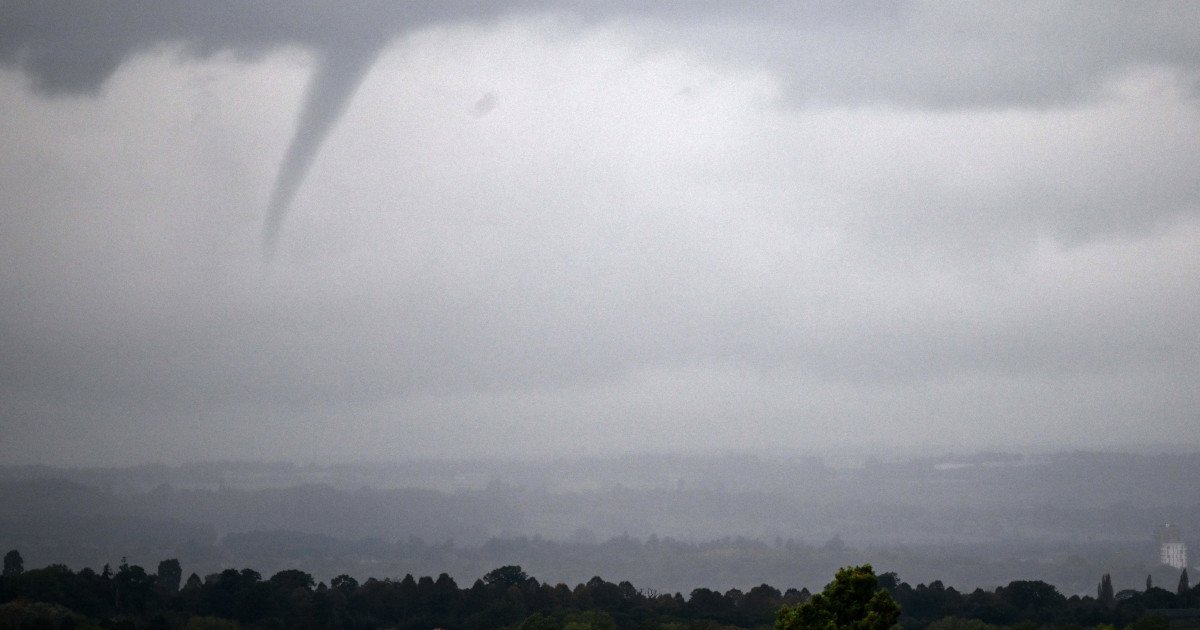
Sports fans and communities across a massive swath of the eastern United States need to keep one eye on the sky this Monday. The National Weather Service has issued a stark warning, placing a dozen states under the threat of potential tornado activity. This severe weather setup could throw a wrench into outdoor plans and travel, reminding everyone that nature sometimes calls an audible.
The zone of concern stretches from the Sunshine State all the way to the Northeast. The states under the potential tornado watch for Monday, March 16, are: Florida, Georgia, South Carolina, North Carolina, Virginia, West Virginia, Maryland, Delaware, New Jersey, Pennsylvania, New York, and Vermont. It's a wide-ranging alert that underscores the volatile atmospheric conditions expected to develop.

Within that broad area, forecasters have pinpointed an elevated danger zone. Four states are currently in the crosshairs for the highest risk of severe weather, including tornadoes. North Carolina is expected to see the largest portion of this threat, joined by Virginia, the northern part of South Carolina, and a small southern portion of West Virginia. Residents and visitors in these regions should be especially vigilant.
This alert follows a weekend of turbulent weather, as detailed in our previous coverage on the expanding tornado watch that put multiple states on notice Sunday night. The pattern of severe storms has been persistent, creating a challenging environment for any outdoor activities. For sports enthusiasts, this kind of forecast is a major disruptor, similar to the scenarios we saw when severe thunderstorms threatened Sunday sports across 11 states.
When a tornado warning is issued, every second counts. Knowing what to do can be the difference between safety and danger. If you are at home, immediately head to your basement, a designated safe room, or an interior room on the lowest floor, away from windows. Don't forget to bring your pets with you if you have time.
The rules change depending on your location. At your workplace or school, follow established tornado drill procedures and move quickly and calmly to the designated shelter. Avoid large, open rooms like cafeterias, gymnasiums, or auditoriums. If you're caught outside, seek shelter in a sturdy building immediately. Sheds, storage facilities, mobile homes, and tents are not safe options.
Perhaps one of the most dangerous places to be is in a vehicle. Driving during a tornado is not safe. The best action is to drive to the closest sturdy shelter. If you cannot reach one, options are severely limited: either get down in your car and cover your head, or—as a last resort—abandon the vehicle and seek shelter in a low-lying area like a ditch or ravine, protecting your head from flying debris.
Staying informed is your first line of defense. Continue to monitor local news broadcasts or a NOAA Weather Radio for the latest updates on watches and warnings. These alerts can change rapidly as storms develop and move. This volatile pattern echoes other recent severe weather events, such as the severe storm threat that put seven states on high alert last Thursday.
As we head into Monday, the primary message from officials is one of preparedness and caution. While we all hope the storms weaken or miss populated areas, having a plan in place is non-negotiable. Let's all stay weather-aware, look out for our neighbors, and prioritize safety above all else as this severe weather system moves through.