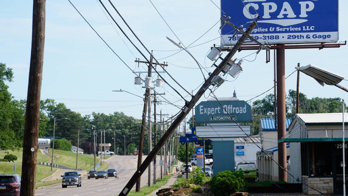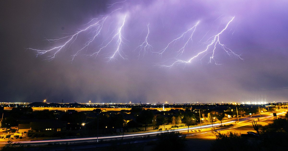
The National Weather Service has raised the alarm for a significant weather event bearing down on the Mid-Atlantic region. An "enhanced" risk of severe storms is forecast to sweep through four states from Sunday evening into the early hours of Monday, bringing a dangerous cocktail of large hail, damaging winds, torrential rain, and frequent lightning.
Target Zone: A Four-State Alert
The states squarely in the crosshairs of this potent system are West Virginia, Maryland, Ohio, and Pennsylvania. Meteorologists are warning residents that this isn't a typical spring shower; the storm's dynamics suggest a heightened potential for significant weather impacts. The threat window opens Sunday evening and persists through the overnight hours, making preparedness before nightfall crucial.

This severe weather alert comes as other parts of the country grapple with their own environmental challenges. Just as Hawaii faces a flash flood emergency, the East Coast is now bracing for its own bout of intense conditions. Furthermore, the timing of this storm could create disruptions beyond daily life, potentially affecting scheduled events in a manner similar to the sports alerts issued for tornado threats in other regions.
Your Game Plan for Severe Weather Safety
When the skies turn threatening, having a clear safety strategy is as important as any game-day plan. The NWS emphasizes that your actions in the initial moments of a warning can make all the difference. First and foremost, stay informed by monitoring local news or a NOAA Weather Radio for the latest watches and warnings—don't rely solely on outdoor cues.
Wherever You Are, Know Your Safe Space
At Home: If a severe thunderstorm warning is issued for your area, immediately move to your pre-identified secure location, such as a basement or an interior room on the lowest floor away from windows. If you have pets and time permits, bring them with you.
At Work or School: Avoid windows at all costs. Do not gather in large, open areas like cafeterias, gymnasiums, or auditoriums, as these structures can be vulnerable to high winds and falling debris.
Outdoors: This is one of the most dangerous places to be. Seek shelter inside a sturdy building immediately. Do not use sheds or storage facilities for protection. Crucially, never take shelter under a tree. Not only does it increase your risk of a lightning strike, but the tree itself could be toppled by strong winds.
In a Vehicle: While a car is safer than being completely exposed, it is not ideal. If you have sufficient time, carefully drive to the closest secure shelter. If caught on the road with no alternative, park away from trees and power lines and remain in the vehicle with your seatbelt on.
This urgent call for preparedness serves as a stark reminder that nature's power demands respect. Just as athletes train for unexpected challenges, communities must be ready for sudden shifts in weather. Staying vigilant and following official guidance is the best defense against this incoming atmospheric onslaught.