The unofficial start of summer is about to get a rude awakening for millions of Americans. A powerful thunderstorm packing 70 mph wind gusts is set to slam three states this Memorial Day weekend, threatening to turn holiday cookouts and beach trips into a battle against the elements.
The National Weather Service has issued a severe thunderstorm watch for parts of Arkansas, Louisiana, and Mississippi, effective Saturday until 6 p.m. CDT. The culprit? A volatile mix of deep Gulf moisture and a weak disturbance spinning across the region, creating the perfect recipe for dangerous weather.

“In the coastal areas of the western and central Gulf, very moist air will be in place. Surface dewpoints in the lower to mid 70s F will contribute to moderate instability by midday,” the National Weather Service warned in a statement. “Thunderstorms will form along sea breeze boundaries during the early to mid afternoon. A few severe wind gusts and a brief tornado will be possible.”
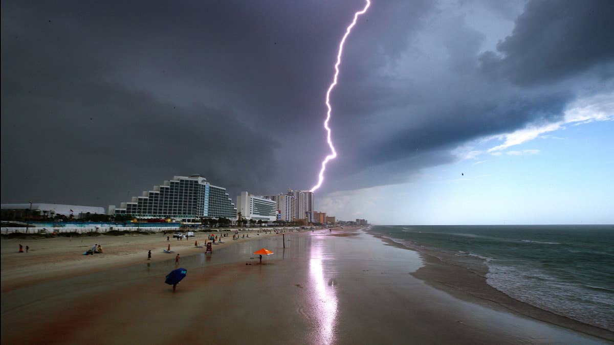
The storm system is expected to organize into a semi-coherent band as it pushes eastward, fueled by peak daytime heating. Forecasters say the primary threats will be damaging straight-line winds, but they haven't ruled out a brief spin-up tornado, particularly along the Gulf Coast. For those heading to the beach, the beach warning issued for four states earlier this week is a stark reminder that the ocean can be just as treacherous as the sky.
“Farther north over the Ark-La-Miss, some heating ahead of a north-south band of showers/thunderstorms associated with an MCV over OK, will contribute to a marginally supportive wind-damage risk,” the NWS added. “Have expanded low-wind probabilities to account for observational trends of a semi-organized band of storms continuing east into the Ark-La-Miss during peak heating.”
But the trouble doesn't stop there. The National Weather Service has also issued flash flood warnings for a much broader swath of the country, stretching from the Ohio Valley down to the central Gulf Coast. “A wet Memorial Day Weekend is on tap for much of the eastern United States, with a slight risk of flash flooding for portions of the Ohio Valley, southern Appalachians, southeast Texas, and the central Gulf Coast,” the agency said. This follows earlier flash flood warnings for four regions that have kept emergency managers on high alert.
For those planning to hit the road or fire up the grill, the message is clear: keep an eye on the sky and have a backup plan. The storms are expected to fire up in the early to mid-afternoon, with the worst conditions likely lasting into the evening. If you're in the affected areas, the NWS advises staying indoors, securing loose outdoor items, and avoiding flooded roadways.
This storm isn't just a weekend spoiler—it's a serious safety concern. With 70 mph winds threatening six states in a separate system earlier this week, the pattern of intense spring storms continues to keep meteorologists busy. The same unstable air mass that brought severe weather to the Plains is now sliding east, colliding with Gulf moisture to create this holiday weekend mess.
As you gather with family and friends to remember those who served, the National Weather Service offers a simple wish: “May you have a safe and reflective Memorial Day Weekend.” To make that happen, it's best to check the forecast before heading out, especially if you're traveling to the Jersey Shore or Delaware beaches, where rip current warnings are already in effect. Stay safe, stay dry, and don't let the weather dampen your spirit—or your holiday.