Sports fans and athletes across a wide swath of the country need to keep one eye on the sky tonight. The National Weather Service has sounded the alarm for a dangerous line of severe thunderstorms set to sweep through seven states, bringing threats that could disrupt evening plans and travel.
Storm Zone: From Texas to the Ohio Valley
The warning covers a significant portion of the central United States, putting millions on alert. The states in the bullseye are Texas, Oklahoma, Arkansas, Missouri, Illinois, Indiana, and Kentucky. Forecasters indicate the extreme weather will ignite Wednesday night and could persist through Friday, creating a multi-day hazard.

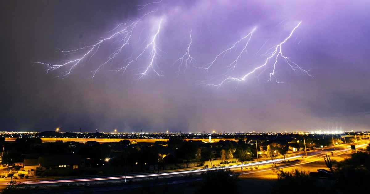
This isn't your typical spring shower. The NWS is warning of a potent mix of large, damaging hail, wind gusts strong enough to cause structural damage, and the potential for tornadoes to spin up. The agency specifically stated, "Isolated to scattered severe thunderstorms are expected through tonight from north-central Texas and eastern Oklahoma to the Ozarks and Lower Ohio Valley." They emphasized that the storms could produce "large hail, localized wind damage, and a tornado or two."
Flash Flooding Adds to the Danger
Beyond the wind and hail, torrential rainfall poses a major secondary threat. The same weather system is expected to dump heavy rain in a short period, raising the risk of sudden flash flooding. "Storms may produce areas of heavy rainfall and localized flash flooding," the National Weather Service cautioned. This makes low-lying areas, underpasses, and small creeks particularly dangerous as water levels can rise with astonishing speed.
For the sports community, this forecast means more than just a rain delay. It's a serious safety concern for anyone with evening games, practices, or travel. High school baseball games, community soccer matches, and outdoor training sessions should have contingency plans. Furthermore, fans driving to or from events in the affected regions must exercise extreme caution.
Staying Safe When Severe Weather Strikes
Knowing the forecast is only half the battle. Being prepared to act is crucial. Here are essential safety tips to remember if warnings are issued for your area:
- Stay Informed: Keep a battery-powered NOAA weather radio or a trusted news app handy to receive immediate updates on watches and warnings.
- At Home: If a severe thunderstorm warning is issued, move immediately to a secure, windowless interior room on the lowest floor. Bring pets with you if possible.
- At Work or School: Avoid windows, large open spaces like gymnasiums and auditoriums, and move to designated shelter areas.
- Outdoors: There is no safe place outside during a severe storm. Get inside a sturdy building immediately. Do not seek shelter under trees, in sheds, or in storage facilities, as these can become deadly in high winds or lightning.
- In a Vehicle: While a car is safer than being outside, it is not safe from hail, falling debris, or flooding. If you have time, drive to the closest substantial shelter. If caught on the road, avoid flooded roadways and pull over safely, away from trees and power lines.
The timing of this system, rolling through during the evening and overnight hours, makes preparedness even more critical. Everyone in the warned areas should ensure their weather alert notifications are enabled and have a plan ready before the skies darken.
While we all love the thrill of competition, safety must come first. Tonight, the biggest opponent for many in the heartland won't be on a field or court—it will be the volatile weather overhead. Stay alert, have a plan, and prioritize getting to safe shelter when warnings are issued.