Fireworks aren't the only thing lighting up the sky this Fourth of July. A powerful storm system is set to unleash 75 mph winds and even a few tornadoes across seven states, turning Independence Day celebrations into a dangerous weather event.
The National Weather Service has issued severe thunderstorm warnings for Colorado, Delaware, Kansas, Maryland, Missouri, Oklahoma, and Pennsylvania as of Saturday morning. These areas could face not only damaging wind gusts but also similar severe weather patterns that have already battered other regions this weekend.

What's Driving the Storms?
Meteorologists point to a combination of rising heat and atmospheric instability. Afternoon temperatures soaring into the upper 90s and low 100s will create a deeply mixed airmass, setting the stage for thunderstorm development. The storms are expected to first form over the Blue Ridge Mountains and Shenandoah Valley early in the afternoon, then push northeastward through northern Virginia, Washington D.C., central Maryland, Delaware, and southern New Jersey.
"Interaction between the modest ascent associated with these features and the unstable airmass forecast to be in place will support thunderstorm development," the National Weather Service said in a statement. "Weak deep-layer shear amid a deeply mixed airmass will support outflow-dominant storm structures, and strong cold pools capable of widespread damaging wind gusts."
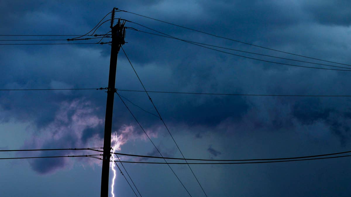
Key Risks: Wind, Hail, and Tornadoes
The primary threat is damaging wind gusts reaching 70 to 75 mph, which can topple trees, damage power lines, and turn outdoor furniture into projectiles. An isolated tornado or two is also possible, especially in the most unstable areas. Later in the afternoon, a similar pattern is expected farther north, from the Allegheny Plateau through the mid-Atlantic and into southern New England.
For those planning beach trips, this weather adds to other July Fourth hazards like flesh-eating bacteria warnings along coastlines.
How to Stay Safe
The National Weather Service emphasizes that preparation is key. Here are their top safety tips for riding out these storms:
- Stay informed: Keep a NOAA Weather Radio or local news app handy for real-time updates on watches and warnings.
- Seek shelter immediately: If a severe thunderstorm warning is issued for your area, go to your secure location—preferably a basement or interior room on the lowest floor. Bring pets if time allows.
- Avoid windows: Stay away from glass and avoid large open rooms like gymnasiums or auditoriums, which offer little protection from wind or hail.
- Never take shelter under a tree: Trees can fall on you or attract lightning. Sheds and storage buildings are also unsafe—only sturdy, enclosed buildings provide real protection.
- Vehicles as last resort: Being in a car is safer than being outside, but if you have time, drive to a sturdy shelter.
These storms follow earlier warnings for two states that already faced similar threats this weekend. As the holiday unfolds, residents across the affected regions are urged to keep an eye on the sky and prioritize safety over celebration.
We're hoping everyone stays safe this Fourth of July weekend. Enjoy the fireworks—but make sure you're watching them from a secure spot.