A powerful weather system is bearing down on a massive swath of the United States, prompting urgent flash flood warnings for residents across ten major states. The National Weather Service has raised the alarm for a serious threat of severe thunderstorms and potentially dangerous flooding from Tuesday, March 3, continuing through the week.
Widespread Severe Weather on the Horizon
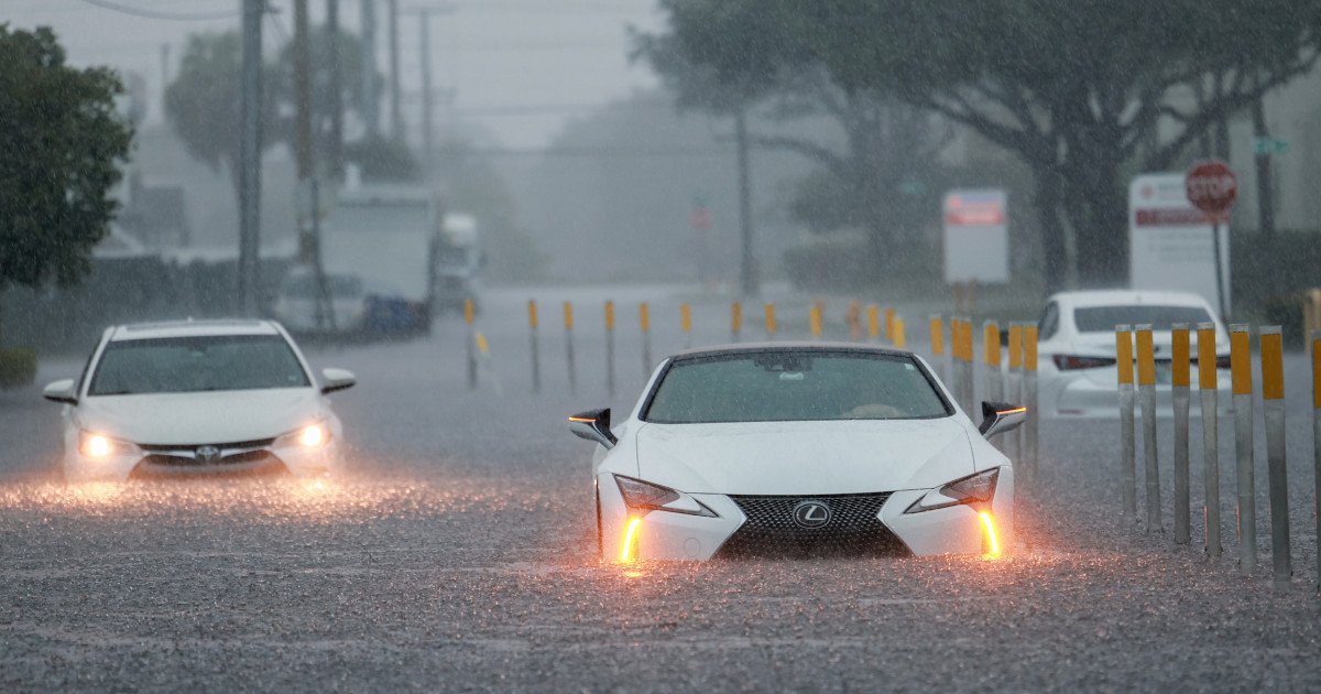
The atmospheric setup is primed for trouble, with rounds of intense showers and thunderstorms expected to march from the Southern Plains into the Midwest. These storms won't just bring lightning and gusty winds; they are packing a heavy punch of rainfall that could quickly overwhelm streets, creeks, and drainage systems. The combination of saturated ground and persistent downpours creates a perfect recipe for rapid, life-threatening flash flooding.

"In addition to the threat of severe weather increasing from the southern Plains to the Midwest the next couple of days, the rounds of showers and thunderstorms bring a marginal threat of flash flooding," cautioned the National Weather Service in their official warning. They issued a critical reminder for all motorists: "When encountering a flooded road, Turn Around, Don't Drown."
States in the Danger Zone
The flash flood warning casts a wide net, placing millions of Americans on high alert. The ten states identified as being at significant risk are:
- Texas
- Oklahoma
- Kansas
- Arkansas
- Missouri
- Illinois
- Indiana
- Ohio
- West Virginia
- Kentucky
This corridor represents a major cross-section of the country, from the heartland to the Ohio River Valley. Residents in these areas should closely monitor local forecasts, as conditions can deteriorate with little warning.
Essential Safety Steps to Take Now
With the threat imminent, preparation is key. Public safety officials emphasize that proactive measures can save lives and property. Your first line of defense is information. Tune into a NOAA Weather Radio or trusted local news stations for real-time updates and official instructions. Never ignore evacuation orders from authorities.
Be acutely aware of your surroundings and have a plan to move to higher ground immediately if flooding develops. It's wise to postpone any non-essential outdoor activities until the storm system passes. Secure your property by tying down or bringing inside patio furniture, toys, and trash cans that could become hazardous projectiles in rushing water.
Protecting Your Home and Family
Inside your home, take steps to mitigate potential damage. Consider unplugging sensitive electronics before flooding occurs, but remember: never touch electrical equipment if you are wet or standing in water. If you have a basement, elevate valuable stored items off the floor. Ensure any sump pump is in good working order. A simple act like clearing debris from street catch basins near your home can help reduce localized street flooding.
Finally, avoid temptation and stay away from flood-prone areas. Do not camp, park, or walk near streams, rivers, or creeks during this period of heavy rain. These areas can transform from tranquil to treacherous in mere minutes. By staying vigilant, prepared, and informed, communities can weather this storm safely. Keep a watchful eye on the sky and heed all warnings—your safety depends on it.