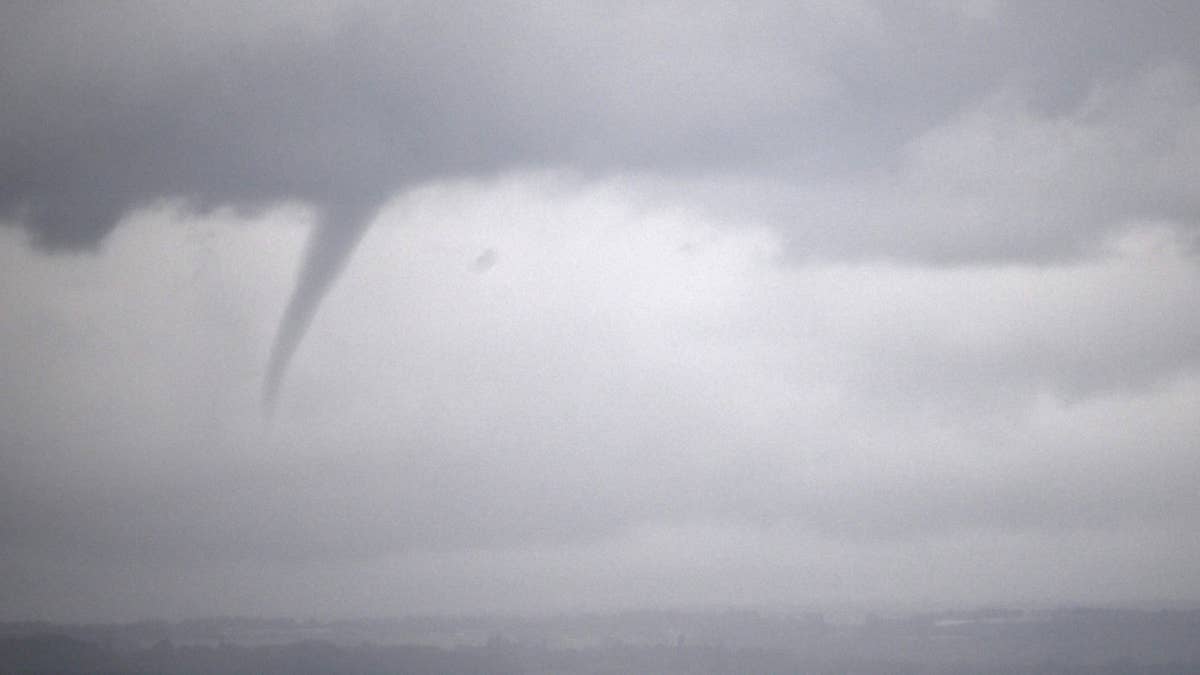
Mother Nature is cranking up the drama this Tuesday, with a massive storm system threatening to unleash tornadoes across a wide swath of the country. The National Weather Service has put 11 states on notice, urging millions to brace for potentially violent weather that could include destructive twisters, damaging winds, and hail the size of baseballs.
This isn't just a run-of-the-mill thunderstorm—forecasters are warning of significant tornadoes that could touch down in the afternoon and evening. The states in the crosshairs stretch from the Southern Plains to the Ohio Valley, including Texas, Oklahoma, Missouri, Arkansas, Louisiana, Illinois, Indiana, Kentucky, Tennessee, Alabama, and Mississippi.

If you live in any of these areas, now is the time to review your safety plan. The storms are expected to intensify quickly, so waiting until the sirens go off could be too late. For a broader look at what's brewing, check out our earlier report on 11 States on Deck for Severe Storms Tomorrow.
What to Expect
This system is packing a serious punch. In addition to tornadoes, residents can expect torrential rain, frequent lightning, and gusty winds that could knock down trees and power lines. Large hail poses a particular threat to vehicles and property, so if you can, move your car under cover.
The National Weather Service has emphasized that the tornado threat is real and warrants immediate attention. They've urged everyone in the warned areas to stay weather-aware and have multiple ways to receive alerts—especially since storms could strike overnight or during the evening commute.
Your Tornado Safety Playbook
When the sky turns ugly, knowing what to do can save your life. Here's a refresher on the best ways to stay safe:
- At home: Head to the basement, a safe room, or an interior closet on the lowest floor. Stay away from windows and bring your pets if you can.
- At work or school: Follow your tornado drill and move to a designated shelter area. Avoid large rooms like gyms or auditoriums—they're too open and risky.
- If you're outside: Get inside a sturdy building immediately. Sheds, storage units, and tents won't cut it. Mobile homes are also extremely dangerous—evacuate if you have time.
- In a vehicle: This is the worst place to be. Drive to the nearest shelter. If you can't make it, pull over, cover your head, or abandon the car for a low-lying area like a ditch.
For more on how to prepare for severe weather, read our guide on 7 States Bracing for Extreme Thunderstorms.
Stay Informed
Keep a NOAA Weather Radio handy, or download a reliable weather app that sends push alerts. Local news stations will also provide live updates as the storms develop. Remember: a tornado watch means conditions are favorable for tornadoes, while a warning means one has been spotted or indicated on radar—take cover immediately.
This is a fast-moving situation, so don't let your guard down. The storm system could shift or intensify, putting additional areas at risk. Stay tuned to updates, and check out our latest on 60 MPH Winds and Baseball-Sized Hail for more context on what's coming.
Stay safe, everyone. We'll keep you posted as this story develops.