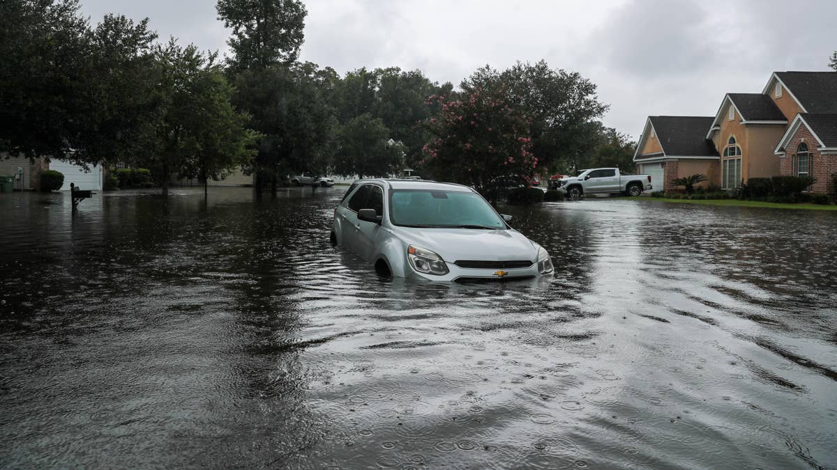
Thursday is shaping up to be a rough one for the Lone Star State. Tropical Storm Bertha is charging toward the Texas coast, and the National Hurricane Center has issued a stark warning: this storm could unleash up to 4 inches of rain per hour in some areas. That's not just a heavy downpour—it's a potential flash flood nightmare.
Earlier this week, forecasters flagged the possibility of dangerous weather, and now the storm is making good on that promise. The National Weather Service Prediction Center reports that a mid-level circulation combined with convergence well south-southwest of Bertha is pushing moisture ashore along the central Texas coast. While fast storm motion and high Flash Flood Guidance might limit widespread flooding, localized hourly rainfall of 2 to 3 inches could still trigger isolated, rate-driven flash flood impacts near coastal communities.

According to the National Weather Service, radar and satellite imagery reveal a compact cluster of convection associated with a mid-level circulation tracking toward the central coast. Offshore rainfall estimates from MRMS have clocked intense rates of 3 to 4 inches per hour within this feature. However, recent trends suggest the convection is weakening slightly as it approaches the shoreline—small comfort for those in its path.
For context, this isn't the first time the Gulf Coast has faced a tropical threat. Just last week, a tropical storm warning hit Florida, putting four states on edge. Now it's Texas's turn to batten down the hatches.
The National Weather Service has released a list of safety tips for anyone in the storm's path. Here's what you need to know:
- Stay away from flood-prone areas like stream beds, drainage ditches, and culverts during heavy rains.
- Move to higher ground if flooding threatens your location.
- Remain alert if you live or work in flood-prone zones—especially during periods of intense rainfall.
- Be extra cautious at night, when flood dangers are harder to spot.
- Never drive into water of unknown depth. Most flash flood deaths happen when people try to drive through floodwaters. Remember: Turn Around, Don’t Drown!
- If your vehicle stalls, abandon it immediately and seek higher ground. Flood waters can rise quickly, engulf a car, and sweep it away.
- Stay out of flooded areas altogether. The water may still be rising and moving swiftly—strong enough to knock you off your feet or carry a vehicle downstream.
These warnings come amid a broader backdrop of extreme weather events. Meanwhile, wildfire smoke has put 17 states on alert as hazardous air drifts south, reminding us that nature doesn't take a day off. And in the sports world, ESPN President Jimmy Pitaro issued a statement as layoffs swept the network, showing that even media giants aren't immune to turbulence.
For now, all eyes are on Texas. The storm is expected to continue its march inland, and while the worst may be concentrated along the coast, everyone in the region should stay weather-aware. Flash floods can develop in minutes, turning a routine commute into a life-threatening situation. The message from officials is clear: don't take chances. If you see water covering the road, find another route. If you're in a low-lying area, head to higher ground. And if you're at home, keep your phone charged and your emergency kit handy.
We're hoping everyone in Texas stays safe. Bertha might not be a hurricane, but with 4 inches of rain per hour, it's packing a punch that demands respect.