As the Fourth of July weekend kicks off, not every state is enjoying clear skies and sunshine. While earlier advisories covered a swath from Colorado to Pennsylvania, the latest focus is squarely on the Midwest. The National Weather Service has issued a severe thunderstorm advisory for parts of Illinois and Indiana, where a cluster of storms is expected to roll through Saturday.
The system, currently moving out of eastern Iowa into northern Illinois, is packing a punch. Meteorologists are warning of damaging wind gusts that could cause power outages and property damage. The storms are forecast to track eastward, with a potential southeastward propagation that could bring the worst weather toward the Indianapolis area by early evening.

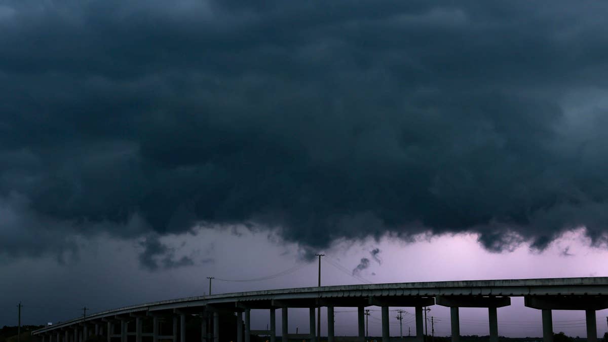
According to the National Weather Service, visible satellite and surface observations show a low-pressure system and a mesoscale convective vortex (MCV) driving the storms. Significant convergence is noted over northwest Illinois, aided by modest southerly winds that are fueling warming and destabilization. Cooler air lingers over parts of southeastern Wisconsin and northeastern Illinois, but areas of heating and warm advection may allow destabilization near the Chicago metro area.
The 12Z sounding from Lincoln, Illinois, reveals high precipitable water values exceeding 1.75 inches, combined with 25-35 knot midlevel westerlies. This potent mix means storm motions will generally be toward the east, with a tendency to propagate southeastward. Residents in the path should brace for potential wind damage and large hail.
This weekend's weather echoes the recent 75 mph winds that rattled two states earlier this week. For those in the affected areas, safety should be the top priority. Here’s what you need to know to stay safe during severe thunderstorms.
Safety Tips for Severe Thunderstorms
When a severe thunderstorm warning is issued, time is of the essence. Follow these steps to protect yourself and your loved ones.
Stay Informed
Keep a NOAA Weather Radio or local news app handy to monitor watches and warnings. Conditions can change rapidly, so staying updated is crucial.
Seek Shelter Immediately
If you hear a warning, go to your secure location—preferably a basement or interior room on the lowest floor. Bring your pets if time allows. Avoid large open spaces like cafeterias, gymnasiums, or auditoriums.
Stay Away from Windows
Damaging wind and large hail can shatter glass. Move to a windowless area, and do not venture into open rooms where debris could pose a risk.
If You're Outdoors
Do not take shelter under a tree—it could fall on you or attract lightning. Sheds and storage facilities are not safe either. Instead, get inside a sturdy building as quickly as possible.
In Your Vehicle
A car is safer than being outside, but it’s not ideal. If you have time, drive to the nearest secure shelter. If not, pull over away from trees and power lines, and stay low in the vehicle.
For those planning beach trips, note that sharks have been spotted at Rockaway Beach, leading to closures. Meanwhile, flesh-eating bacteria warnings have been issued in three states ahead of holiday beach plans. Stay safe and enjoy the holiday responsibly.