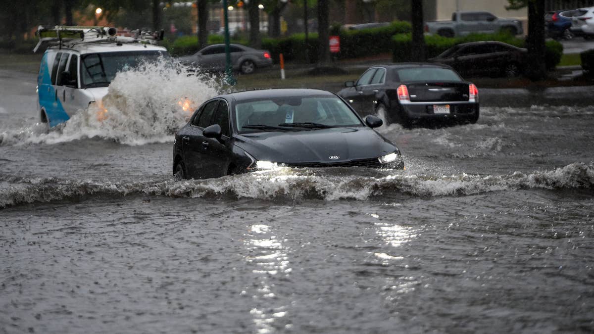
Mother Nature is cranking up the pressure on Friday, June 26, as a relentless storm system slams parts of the central U.S. with torrential downpours. The National Weather Service has issued a flood watch for four states—Arkansas, Kansas, Missouri, and Oklahoma—where repeated showers and thunderstorms are dumping up to two inches of rain every hour. This isn't just a sprinkle; it's a full-on deluge that's turning roads into rivers and putting millions on edge.
The trouble started brewing overnight, with radar showing thunderstorms building westward and then training east-southeast across southern Kansas. These storms have been churning for hours, and they're not letting up anytime soon. According to the NWS, "Recent hourly rainfall measured by MRMS has exceeded 1.5 inches in southern Kansas, and 6-hour rainfall has been above 4 inches already tonight leading to locally significant flash flooding near Wichita." That's a lot of water in a short time, and it's only the beginning.

As the system pushes east into Missouri and south into Oklahoma, forecasters warn that the heavy rain could continue for several more hours. While there's hope that the event will eventually wane, the NWS notes that conditions are ripe for more trouble. "Locally accelerated and backed 850mb inflow in the vicinity of a wave of low pressure will still drive impressive thermodynamic advection," they explain, adding that moisture levels and instability could fuel additional storms. Translation: this storm has legs, and it's not done yet.
Residents in the affected areas should be on high alert, especially as night falls. Flood dangers are harder to spot in the dark, so it's crucial to stay vigilant. The NWS recommends avoiding flood-prone zones like stream beds, drainage ditches, and culverts. If flooding threatens your area, move to higher ground immediately. This is a serious situation, and safety comes first.
This weather event echoes recent warnings in other parts of the country, including gusty winds spark critical fire alerts across 5 western states, showing how extreme weather is becoming a recurring theme. Meanwhile, the Gulf region is bracing for its own challenges, as a tropical cyclone threatens gulf states with 12 inches of rain. It's a reminder that nature doesn't take days off.
For now, the focus is on the four states under the flood watch. The NWS is keeping a close eye on the situation, using high-resolution models to predict where the rain will hit hardest. They estimate a 30-50% chance of rain rates reaching 1 inch per hour, with a 10-20% chance of hitting 2 inches per hour. With cells backbuilding to the west and training along the boundary, some areas could see 3 inches or more of accumulation. That's enough to cause serious flooding, especially in low-lying spots.
Here's a quick rundown of what to do if you're in the danger zone:
- Stay indoors and avoid travel unless absolutely necessary.
- Never drive through flooded roads—turn around, don't drown.
- Keep your phone charged and monitor local weather alerts.
- Have an emergency kit ready with water, food, and flashlights.
This storm is a stark reminder that weather can turn on a dime, even in the middle of summer. Whether you're in Kansas, Missouri, Arkansas, or Oklahoma, stay safe and stay informed. We're all hoping this passes without major incident, but it's better to be prepared than caught off guard.
As the cleanup from this storm begins, officials will likely assess damage and issue further warnings. For now, the message is clear: respect the rain, and don't take chances. If you're in a flood-prone area, consider this your wake-up call. Stay safe out there.