Just when you thought spring had sprung, Mother Nature is delivering a frigid reminder that winter isn't done yet. A potent late-season snowstorm is gearing up to unleash its fury on the Upper Midwest this Saturday, targeting Minnesota, North Dakota, and South Dakota with a brutal mix of heavy snow and freezing rain.
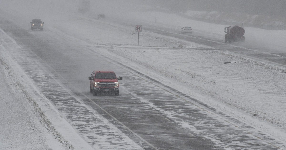
The National Weather Service has sounded the alarm, issuing severe storm warnings for the tri-state region. Forecasters warn that snow will intensify overnight Friday and continue through Saturday, with snowfall rates potentially reaching a staggering one to two inches per hour. This isn't just a light dusting; widespread accumulations are expected to exceed eight inches, with a significant chance that some areas could be buried under more than a foot of snow.

"Snow will expand from the Dakotas into Minnesota this evening, becoming heavy overnight continuing through Saturday," stated the National Weather Service. They highlighted a 70-90% probability of those intense snowfall rates, which, combined with gusty winds, will create a nightmare for travelers. The result will be snow-packed roads, significant blowing and drifting snow, and dangerously reduced visibility.
Adding another layer of peril to the situation is the forecast for freezing rain. This icy glaze will compound the hazardous travel situation, making roads exceptionally slick and treacherous. The NWS is strongly advising residents to avoid any unnecessary travel on Saturday if possible. This kind of weather event can disrupt even the best-laid plans, whether it's a weekend getaway or a trip to catch a game. It's a stark reminder of how quickly conditions can change, similar to the disruptions seen when a 100 MPH wind storm targets sports travel or when a tornado watch threatens Thursday night sports across the region.
Staying Safe on Slick Roads
For those who must venture out, extreme caution is paramount. Here are essential winter driving tips to help you navigate the storm safely:
- Slow Down: This is the golden rule. Reduce your speed significantly to account for the drastically lower traction on snow and ice.
- Gentle Movements: Accelerate and decelerate slowly. Sudden actions can lead to skids. It takes much longer to stop on icy roads.
- Increase Following Distance: Expand the space between you and the car ahead to at least five to six seconds. This gives you a critical buffer for stopping.
- Brake with Care: Know your vehicle's brakes. Apply steady, firm pressure. If you have anti-lock brakes, do not pump them.
- Maintain Momentum: If you can avoid coming to a complete stop, do so. It's easier to keep rolling slowly than to start from a standstill on an incline.
- Handle Hills Wisely: Never gun your engine to power up a hill; you'll only spin your wheels. Build a little speed on a flat section before the ascent, and let that momentum carry you up. Coast down the other side as slowly as possible.
This unexpected blast of winter serves as a crucial reminder for all drivers to be prepared. While this storm is creating a literal firestorm of snow, it's a different kind of controversy making waves elsewhere, like the firestorm ignited by 'work for free' advice in sports media or the firestorm of fan reactions over new NFL uniforms.
As the region batten down the hatches, the focus is squarely on safety. Stay informed with the latest forecasts from the National Weather Service, prepare an emergency kit for your vehicle, and heed all travel advisories. This April snowstorm is a formidable opponent, but with smart preparation and cautious decisions, everyone can stay safe until spring finally decides to stick around for good.