Sports fans across America's heartland need to keep one eye on the sky today. The National Weather Service has raised the alarm for a significant severe weather outbreak targeting five states, with tornadoes posing a serious threat to communities and potentially disrupting travel and local events.
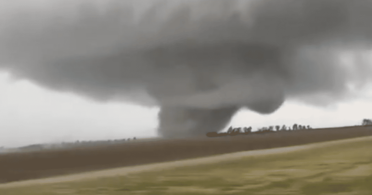
Forecasters are tracking a powerful storm system expected to unleash extreme thunderstorms across a wide swath of the central United States on Thursday and continuing into Friday. The agency has designated a Level 3 out of 5 "Enhanced" risk for severe conditions, indicating a substantial threat that demands public attention and preparedness.

"There is a Level 3 out of 5 risk for severe weather today and Friday," the National Weather Service stated in its official warning. "Large hail, severe wind gusts, and tornadoes will be possible both days." This isn't just about heavy rain and lightning; the volatile atmospheric setup could spawn dangerous, rotating storms capable of producing significant damage.
States in the Danger Zone
The heightened risk zone squarely targets a quintet of states familiar with springtime severe weather. Residents and visitors in the following areas should be particularly vigilant and have a safety plan ready:
- Texas
- Oklahoma
- Kansas
- Nebraska
- Missouri
This corridor, often called "Tornado Alley," is entering its most active period, and today's forecast underscores the very real dangers that can materialize with little warning. The combination of ingredients—including strong wind shear and ample moisture—creates a prime environment for supercell thunderstorms, the type most likely to produce tornadoes.
Critical Safety Steps When Severe Weather Strikes
With lives potentially on the line, knowing what to do before and during a tornado warning is non-negotiable. The National Weather Service and emergency managers emphasize the following life-saving actions:
Stay Informed: Your first line of defense is information. Keep a battery-powered NOAA Weather Radio handy or monitor trusted local news outlets for the latest watches and warnings. A "watch" means conditions are favorable; a "warning" means a tornado has been sighted or indicated by radar—it's time to act immediately.
At Home: If a tornado warning is issued for your location, move quickly to your designated safe place. This should be a basement, storm cellar, or an interior room on the lowest floor, away from windows. A bathroom or closet can offer crucial protection. Bring your pets with you if you can do so safely without delay.
At Work or School: Follow established tornado drill procedures without hesitation. Proceed calmly to the designated shelter area, which is typically an interior hallway or room on the lowest level. Avoid large, open spaces like gymnasiums, cafeterias, or auditoriums where roof failure poses a greater risk.
If You're Outdoors or in a Vehicle: Do not try to outrun a tornado. Your goal is to get inside a substantial, reinforced building as fast as possible. Remember, mobile homes, tents, sheds, and storage facilities are not safe. If you're driving and cannot reach a sturdy building, options are severely limited. As a last resort, you can either park the car, stay belted in, and cover your head below the windows, or abandon the vehicle to lie flat in a ditch or low-lying area, covering your head. This is extremely dangerous, so seeking solid shelter should always be the primary objective.
This developing weather situation serves as a stark reminder that nature's power can change the game in an instant. Whether you have weekend sports plans, are traveling to a game, or are simply at home, please take these warnings seriously. Stay alert, have a plan, and prioritize safety above all else.