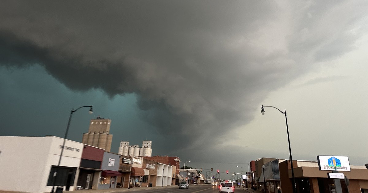
The central United States is bracing for another round of volatile weather as a potent storm system takes aim, threatening to unleash a significant severe weather outbreak this Friday. Following days of turbulent conditions across the Midwest and South, forecasters are sounding the alarm for a heightened risk of dangerous tornadoes in a concentrated region.
According to the latest forecasts from the National Weather Service, four states—Texas, Oklahoma, Arkansas, and Missouri—are now under an Enhanced Risk, classified as Level 3 out of 5, for severe storms on Friday. The most concerning aspect of this forecast is a notable 10% probability of "major" tornadoes, specifically those rated EF-2 or higher, capable of causing considerable damage.

"There is a Level 3 out of 5 risk (Enhanced) for severe weather today and Friday. Large hail, severe wind gusts, and tornadoes will be possible both days," the National Weather Service warned in its latest advisory. This alert underscores a multi-faceted threat extending beyond tornadoes, with the same region facing a 30% chance of severe, large hail and a 10% chance of damaging straight-line winds.
A Multi-Hazard Severe Weather Event
This isn't just a tornado story. The approaching system is expected to fuel a barrage of hazardous conditions. Communities in the threat zone should prepare for powerful thunderstorms capable of producing torrential rainfall, frequent and intense lightning, and wind gusts strong enough to topple trees and power lines. The large hail threat is particularly significant, posing risks to property, vehicles, and anyone caught outdoors.
The atmospheric ingredients are coming together in a concerning way, creating an environment ripe for rotating supercell thunderstorms. These long-lived storms are the primary producers of the strongest tornadoes and largest hail. Residents across the Plains and Mid-South should remain vigilant throughout the day Friday, as conditions are expected to deteriorate rapidly.
Critical Safety Information
With such a serious forecast, having a plan is non-negotiable. Safety experts emphasize that knowing what to do before a tornado warning is issued can save lives. Your action plan should be clear and practiced.
- At Home: Identify your safest room—a basement, storm cellar, or an interior room on the lowest floor with no windows. Don't forget to include your pets in your plan.
- At Work or School: Immediately follow established tornado drill procedures. Move quickly to the designated shelter area, avoiding large, open spaces like gymnasiums or cafeterias.
- When Outdoors or in a Vehicle: This is extremely dangerous. If you see a tornado and time allows, immediately drive to the nearest sturdy building for shelter. If you cannot reach a building, as a last resort, abandon your car and lie flat in a low-lying ditch or ravine, covering your head. Never seek shelter under a highway overpass.
Staying informed is your first line of defense. Keep a battery-powered NOAA Weather Radio handy and monitor trusted local news sources for the latest watches and warnings. A tornado watch means conditions are favorable; a tornado warning means one has been sighted or indicated on radar—this is when you must act immediately.
This severe weather event serves as a stark reminder of spring's volatile nature in Tornado Alley and the Dixie Alley extension. While the 10% tornado risk area is focused, surrounding regions should also stay alert, as the exact placement of the most dangerous storms can shift. The key for everyone in the path of this system is to take the threat seriously, prepare now, and stay weather-aware throughout the day Friday to ensure you and your loved ones stay safe.